 |
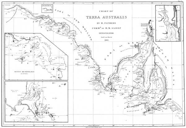
Flinders, Matthew. A voyage to Terra Australis : Atlas. - Plate IV. 'Chart of Terra Australis. South coast. Sheet III, 1802.'Plate IV. Flinders, Matthew. Chart of Terra Australis. South coast. Sheet III, 1802 by M. Flinders, Commr. of H.M. Sloop Investigator (1814). This chart was originally published in 1814 as part of the atlas volume of Matthew Flinders' three volume publication A voyage to Terra Australis. This facsimile edition of the chart was published in 1966 by the Libraries Board of South Australia. The chart depicts the South Australian coastline from the head of the Great Australian Bight to Encounter Bay. This is the stretch of coast of which Flinders was the first European surveyor. The chart covers the area explored by Flinders between 27 January to 8 April 1802, including the site of the 1802 encounter between Flinders and Baudin. Inset charts of Nuyts Archipelago, Port Lincoln and the head of Spencer Gulf are included. The chart includes soundings and notes on currents, coastal vegetation and terrain. Click here for catalogue information on this item.
A copy of this item may be made for private use, but further publication requires the permission of The State Library of South Australia. |


