 |
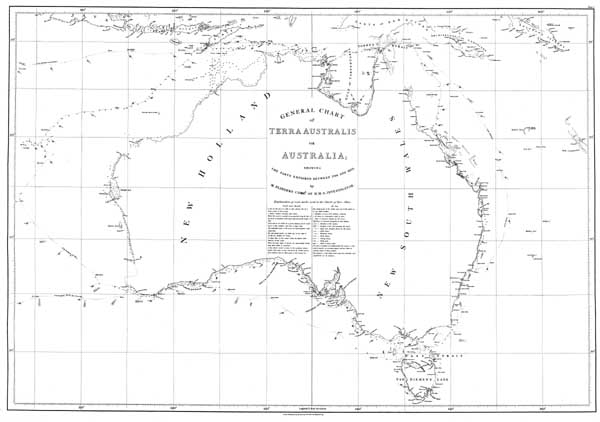
Flinders, Matthew. A voyage to Terra Australis : Atlas. - Plate I. 'General chart of Terra Australis or Australia, showing the parts explored between 1798 and 1803.'Plate 1. Flinders, Matthew. General chart of Terra Australis or Australia, showing the parts explored between 1798 and 1803 by M. Flinders, Commr. of H.M.S. Investigator (1814). This chart was originally published in 1814 as part of the atlas volume of Matthew Flinders' three volume publication A voyage to Terra Australis. This facsimile edition of the chart was published in 1966 by the Libraries Board of South Australia. This chart was the first map published that used the name "Australia". It was the second time that a map showing the recognisable and relatively complete outline of Australia was published. Louis de Freycinet's map of 1812 was the first published map to depict the entire Australian coastline. The chart includes soundings and notes on currents, coastal vegetation and terrain. Click here for catalogue information on this item.
A copy of this item may be made for private use, but further publication requires the permission of The State Library of South Australia. |


